- Our Story
- Publications & Resources
- Publications & Resources
- Publications
- IEEE Signal Processing Magazine
- IEEE Journal of Selected Topics in Signal Processing
- IEEE Signal Processing Letters
- IEEE Transactions on Computational Imaging
- IEEE Transactions on Image Processing
- IEEE Transactions on Information Forensics and Security
- IEEE Transactions on Multimedia
- IEEE Transactions on Signal and Information Processing over Networks
- IEEE Transactions on Signal Processing
- IEEE TCI
- IEEE TSIPN
- Data & Challenges
- Submit Manuscript
- Guidelines
- Information for Authors
- Special Issue Deadlines
- Overview Articles
- Top Accessed Articles
- SPS Newsletter
- SigPort
- SPS Resource Center
- Publications FAQ
- Blog
- News
- Dataset Papers
- Conferences & Events
- Community & Involvement
- Professional Development
- For Volunteers
- Information for Authors-OJSP
-
Home
ICASSP@50: A Recap [Conference Highlights]
Conversational Agents in the Era of Large Language Models
Conferences Events IEEE Signal Processing Magazine IEEE SPL Article IEEE TIFS Article IEEE TMM Article IEEE TSP Article Jobs in Signal Processing Lectures Machine Learning Seasonal Schools Signal Processing News SPM Article SPS Distinguished Lectures SPS Newsletter Article SPS Webinar SPS Webinars SPS Webinar Series Webinar webinars -
Our Story
What is Signal Processing?

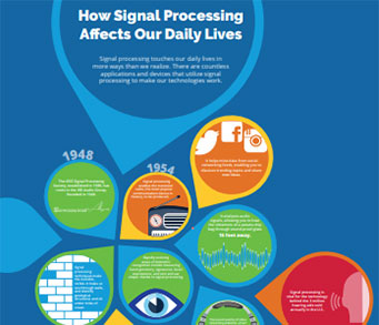
The technology we use, and even rely on, in our everyday lives –computers, radios, video, cell phones – is enabled by signal processing. Learn More » -
Publications & Resources
-
SPS Resources
- Signal Processing Magazine The premier publication of the society.
- SPS Newsletter Monthly updates in Signal Processing
- SPS Resource Center Online library of tutorials, lectures, and presentations.
- SigPort Online repository for reports, papers, and more.
- SPS Feed The latest news, events, and more from the world of Signal Processing.
-
SPS Resources
-
Conferences & Events
-
Community & Involvement
-
Membership
- Join SPS The IEEE Signal Processing Magazine, Conference, Discounts, Awards, Collaborations, and more!
- Chapter Locator Find your local chapter and connect with fellow industry professionals, academics and students
- Women in Signal Processing Networking and engagement opportunities for women across signal processing disciplines
- Students Scholarships, conference discounts, travel grants, SP Cup, VIP Cup, 5-MICC
- Young Professionals Career development opportunities, networking
- Get Involved
-
Technical Committees
- Applied Signal Processing Systems
- Audio and Acoustic Signal Processing
- Bio Imaging and Signal Processing
- Computational Imaging
- Image Video and Multidimensional Signal Processing
- Information Forensics and Security
- Machine Learning for Signal Processing
- Multimedia Signal Processing
- Sensor Array and Multichannel
- Signal Processing for Communication and Networking
- Signal Processing Theory and Methods
- Speech and Language Processing
- Technical Working Groups
- More TC Resources
-
Membership
-
Professional Development
-
Professional Development
- Signal Processing Mentorship Academy (SigMA) Program
- Micro Mentoring Experience Program (MiME)
- Distinguished Lecturer Program
- Distinguished Lecturers
- Distinguished Lecturer Nominations
- Past Lecturers
- Distinguished Industry Speaker Program
- Distinguished Industry Speakers
- Distinguished Industry Speaker Nominations
- Industry Resources
- IEEE Training Materials
- Jobs in Signal Processing: IEEE Job Site
-
Career Resources
- SPS Education Program Educational content in signal processing and related fields.
- Distinguished Lecturer Program Chapters have access to educators and authors in the fields of Signal Processing
- Job Opportunities Signal Processing and Technical Committee specific job opportunities
- Job Submission Form Employers may submit opportunities in the area of Signal Processing.
-
Professional Development
-
For Volunteers
-
For Board & Committee Members
- Board Agenda/Minutes* Agendas, minutes and supporting documentation for Board and Committee Members
- SPS Directory* Directory of volunteers, society and division directory for Board and Committee Members.
- Membership Development Reports* Insight into the Society’s month-over-month and year-over-year growths and declines for Board and Committee Members
-
For Board & Committee Members
Popular Pages
Today's:
- Information for Authors
- ICASSP@50: A Recap [Conference Highlights]
- (ICME 2026) 2026 IEEE International Conference on Multimedia and Expo
- IEEE JSTSP Special Issue on Advanced AI and Signal Processing for Low-Altitude Wireless Networks
- IEEE Transactions on Image Processing
- IEEE Transactions on Information Forensics and Security
- IEEE Transactions on Multimedia
- Information for Authors-SPL
- Conference Call for Papers
- (CAI 2026) IEEE Conference on Artificial Intelligence 2026
- IEEE Signal Processing Letters
- Guidelines
- IEEE Transactions on Audio, Speech and Language Processing
- Submit a Manuscript
- Editorial Board Nominations
All time:
- Information for Authors
- Submit a Manuscript
- IEEE Transactions on Image Processing
- IEEE Transactions on Information Forensics and Security
- IEEE Transactions on Multimedia
- IEEE Transactions on Audio, Speech and Language Processing
- IEEE Signal Processing Letters
- IEEE Transactions on Signal Processing
- Conferences & Events
- IEEE Journal of Selected Topics in Signal Processing
- Information for Authors-SPL
- Conference Call for Papers
- Signal Processing 101
- IEEE Signal Processing Magazine
- Guidelines
Last viewed:
- Editorial Board
- ICASSP@50: A Recap [Conference Highlights]
- SPS Scholarship Program
- Students
- IEEE Transactions on Audio, Speech and Language Processing
- Publications & Resources
- Guidelines for Preparing Electronic Graphics
- (ICIP 2026) 2026 IEEE International Conference on Image Processing
- IEEE Transactions on Image Processing
- IEEE Signal Processing Cup 2025
- IEEE SPS School on Networked Federated Learning: Theory, Algorithms and Applications
- Call for Proposals: (SLT 2026) 2026 IEEE Workshop on Spoken Language Technology
- (ISBI 2024) 2024 IEEE International Symposium on Biomedical Imaging
- Information for Authors
- IEEE Transactions on Multimedia
Fire, Water, and Signal Processing: Researchers are turning to signal processing to help them address challenges posed by two of the planet’s fundamental forces
You are here
Publications & Resources
Signal Processing Magazine
For Authors
Top Reasons to Join SPS Today!
1. IEEE Signal Processing Magazine
2. Signal Processing Digital Library*
3. Inside Signal Processing Newsletter
4. SPS Resource Center
5. Career advancement & recognition
6. Discounts on conferences and publications
7. Professional networking
8. Communities for students, young professionals, and women
9. Volunteer opportunities
10. Coming soon! PDH/CEU credits
Click here to learn more.
Fire, Water, and Signal Processing: Researchers are turning to signal processing to help them address challenges posed by two of the planet’s fundamental forces
Wildfire Damage Watch
Stanford University and California Polytechnic State University (Cal Poly) researchers have developed a system that’s designed to help people driven out of their homes by massive wildfires to discover if their residences were damaged or destroyed by the giant infernos. The team’s DamageMap technology combines artificial intelligence (AI) and signal processing to provide rapid visual building assessments, helping displaced homeowners to see if their homes were damaged or destroyed by the blaze. Instead of comparing before and after photos, the researchers trained their system to rely entirely on postfire images.
The project’s roots extend back to November 2018, when two giant wildfires—“Camp” and “Woosley”—broke out virtually simultaneously in Northern and Southern California. “The ‘Camp’ fire was the largest, fastest, and most deadly fire to date in California history,” says team member G. Andrew Fricker, a Cal Poly assistant professor. Tens of thousands of people from both fires had to evacuate quickly, leaving without any knowledge of the final fate of their homes and businesses—sometimes for weeks or even months. Ultimately, over 18,000 structures burned completely to the ground, yet approximately 30,000 structures were partially damaged by fire or heat. “It was clear there is a need to get reliable information out after a natural disaster, without slowing emergency efforts, both for personal and insurance purposes,” he notes.
Currently, wildfire damage assessment requires trained people going door-to-door to check on the status of every building in the affected area. While DamageMap isn’t intended to replace in-person damage classification, it can be used as a supplementary tool that offers rapid results while providing the exact locations of identified buildings.
SPS Social Media
- IEEE SPS Facebook Page https://www.facebook.com/ieeeSPS
- IEEE SPS X Page https://x.com/IEEEsps
- IEEE SPS Instagram Page https://www.instagram.com/ieeesps/?hl=en
- IEEE SPS LinkedIn Page https://www.linkedin.com/company/ieeesps/
- IEEE SPS YouTube Channel https://www.youtube.com/ieeeSPS
Home | Sitemap | Contact | Accessibility | Nondiscrimination Policy | IEEE Ethics Reporting | IEEE Privacy Policy | Terms | Feedback
© Copyright 2025 IEEE - All rights reserved. Use of this website signifies your agreement to the IEEE Terms and Conditions.
A public charity, IEEE is the world's largest technical professional organization dedicated to advancing technology for the benefit of humanity.


