- Our Story
- Publications & Resources
- Publications & Resources
- Publications
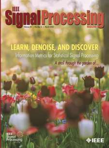
- IEEE Signal Processing Magazine
- IEEE Journal of Selected Topics in Signal Processing
- IEEE Signal Processing Letters
- IEEE Transactions on Computational Imaging
- IEEE Transactions on Image Processing
- IEEE Transactions on Information Forensics and Security
- IEEE Transactions on Multimedia
- IEEE Transactions on Signal and Information Processing over Networks
- IEEE Transactions on Signal Processing
- IEEE TCI
- IEEE TSIPN
- Data & Challenges
- Submit Manuscript
- Guidelines
- Information for Authors
- Special Issue Deadlines
- Overview Articles
- Top Accessed Articles
- SPS Newsletter
- SigPort
- SPS Resource Center
- Publications FAQ
- Blog
- News
- Dataset Papers
- Conferences & Events
- Community & Involvement
- Professional Development
- For Volunteers
- Information for Authors-OJSP
-
Home
Conferences Events IEEE Signal Processing Magazine IEEE SPL Article IEEE TIFS Article IEEE TMM Article IEEE TSP Article Jobs in Signal Processing Lectures Machine Learning Seasonal Schools Signal Processing News SPM Article SPS Distinguished Lectures SPS Newsletter Article SPS Webinar SPS Webinars SPS Webinar Series Webinar webinars
-
Our Story
What is Signal Processing?

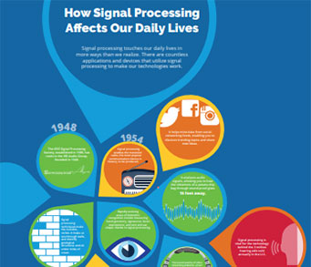
The technology we use, and even rely on, in our everyday lives –computers, radios, video, cell phones – is enabled by signal processing. Learn More » -
Publications & Resources
-
SPS Resources
- Signal Processing Magazine The premier publication of the society.
- SPS Newsletter Monthly updates in Signal Processing
- SPS Resource Center Online library of tutorials, lectures, and presentations.
- SigPort Online repository for reports, papers, and more.
- SPS Feed The latest news, events, and more from the world of Signal Processing.
-
SPS Resources
-
Conferences & Events
-
Community & Involvement
-
Membership
- Join SPS The IEEE Signal Processing Magazine, Conference, Discounts, Awards, Collaborations, and more!
- Chapter Locator Find your local chapter and connect with fellow industry professionals, academics and students
- Women in Signal Processing Networking and engagement opportunities for women across signal processing disciplines
- Students Scholarships, conference discounts, travel grants, SP Cup, VIP Cup, 5-MICC
- Young Professionals Career development opportunities, networking
- Get Involved
-
Technical Committees
- Applied Signal Processing Systems
- Audio and Acoustic Signal Processing
- Bio Imaging and Signal Processing
- Computational Imaging
- Image Video and Multidimensional Signal Processing
- Information Forensics and Security
- Machine Learning for Signal Processing
- Multimedia Signal Processing
- Sensor Array and Multichannel
- Signal Processing for Communication and Networking
- Signal Processing Theory and Methods
- Speech and Language Processing
- Technical Working Groups
- More TC Resources
-
Membership
-
Professional Development
-
Professional Development
- Signal Processing Mentorship Academy (SigMA) Program
- Micro Mentoring Experience Program (MiME)
- Distinguished Lecturer Program
- Distinguished Lecturers
- Distinguished Lecturer Nominations
- Past Lecturers
- Distinguished Industry Speaker Program
- Distinguished Industry Speakers
- Distinguished Industry Speaker Nominations
- Industry Resources
- IEEE Training Materials
- Jobs in Signal Processing: IEEE Job Site
-
Career Resources
- SPS Education Program Educational content in signal processing and related fields.
- Distinguished Lecturer Program Chapters have access to educators and authors in the fields of Signal Processing
- Job Opportunities Signal Processing and Technical Committee specific job opportunities
- Job Submission Form Employers may submit opportunities in the area of Signal Processing.
-
Professional Development
-
For Volunteers
-
For Board & Committee Members
- Board Agenda/Minutes* Agendas, minutes and supporting documentation for Board and Committee Members
- SPS Directory* Directory of volunteers, society and division directory for Board and Committee Members.
- Membership Development Reports* Insight into the Society’s month-over-month and year-over-year growths and declines for Board and Committee Members
-
For Board & Committee Members
Popular Pages
Today's:
- Information for Authors
- (ICME 2026) 2026 IEEE International Conference on Multimedia and Expo
- IEEE Transactions on Information Forensics and Security
- IEEE Transactions on Image Processing
- IEEE Transactions on Multimedia
- Submit a Manuscript
- IEEE Transactions on Audio, Speech and Language Processing
- (ISBI 2026) 2026 IEEE 23rd International Symposium on Biomedical Imaging
- IEEE Journal of Selected Topics in Signal Processing
- IEEE Transactions on Signal Processing
- Conference Call for Papers
- Information for Authors-SPL
- Signal Processing Cup
- Guidelines
- (ASRU 2025) 2025 IEEE Automatic Speech Recognition and Understanding Workshop
All time:
- Information for Authors
- Submit a Manuscript
- IEEE Transactions on Image Processing
- IEEE Transactions on Information Forensics and Security
- IEEE Transactions on Multimedia
- IEEE Transactions on Audio, Speech and Language Processing
- IEEE Signal Processing Letters
- IEEE Transactions on Signal Processing
- Conferences & Events
- IEEE Journal of Selected Topics in Signal Processing
- Information for Authors-SPL
- Conference Call for Papers
- Signal Processing 101
- IEEE Signal Processing Magazine
- Guidelines
Last viewed:
- IEEE Transactions on Image Processing
- Access Restricted
- Membership
- Editorial Board
- IEEE Transactions on Multimedia
- Editorial Board
- Information for Authors
- 2024 SPS Scholarship Recipients
- About TSIPN
- 2026 IEEE 1st Annual Integrated Sensing and Communication Conference (ISAC)
- Overview Articles
- (ISBI 2025) 2025 IEEE International Symposium on Biomedical Imaging
- IEEE Transactions on Audio, Speech and Language Processing
- Unified EDICS
- IEEE Transactions on Information Forensics and Security
Radio Map Estimation: A data-driven approach to spectrum cartography
You are here
Publications & Resources
Signal Processing Magazine
For Authors
Top Reasons to Join SPS Today!
1. IEEE Signal Processing Magazine
2. Signal Processing Digital Library*
3. Inside Signal Processing Newsletter
4. SPS Resource Center
5. Career advancement & recognition
6. Discounts on conferences and publications
7. Professional networking
8. Communities for students, young professionals, and women
9. Volunteer opportunities
10. Coming soon! PDH/CEU credits
Click here to learn more.
Radio Map Estimation: A data-driven approach to spectrum cartography
Radio maps characterize quantities of interest in radio communication environments, such as the received signal strength and channel attenuation, at every point of a geographical region. Radio map estimation (RME) typically entails interpolative inference based on spatially distributed measurements. In this tutorial article, after presenting some representative applications of radio maps, the most prominent RME methods are discussed. Starting from simple regression, the exposition gradually delves into more sophisticated algorithms, eventually touching upon state-of-the-art techniques. To gain insight into this versatile toolkit, illustrative toy examples will also be presented.
Spectrum cartography comprises a collection of techniques used to construct and maintain radio maps, which provide useful information on the radio-frequency (RF) landscape, such as the received signal power, interference power, power spectral density (PSD), electromagnetic absorption, and channel gain across a geographic area; see, e.g., [1], [2], and [3]. A quick overview of the most representative types of radio maps is provided in Table 1.
Radio maps find a myriad of applications in wireless communications and networking, such as network planning, interference coordination and mitigation, power control, resource allocation, handoff management, multihop routing, dynamic spectrum access, and cognitive radio networking tasks; see [4] and [5] and the references therein. Radio maps are also useful for localization [2] and tomography [6].
Arguably, spectrum cartography can be traced back to the application of Maxwell’s equations to characterize the propagation of radio waves across space. However, due to insufficient computational capacity, this approach has been traditionally confined to problems involving relatively simple geometries, such as determining the electromagnetic field radiated by a dipole. To analyze more complex environments, numerous empirical models have been developed, such as the well-known P recommendations from the International Telecommunication Union–Radiocommunication Sector. Unfortunately, this kind of model often fails to provide estimates that are accurate enough for a given application [7].
SPS Social Media
- IEEE SPS Facebook Page https://www.facebook.com/ieeeSPS
- IEEE SPS X Page https://x.com/IEEEsps
- IEEE SPS Instagram Page https://www.instagram.com/ieeesps/?hl=en
- IEEE SPS LinkedIn Page https://www.linkedin.com/company/ieeesps/
- IEEE SPS YouTube Channel https://www.youtube.com/ieeeSPS
Home | Sitemap | Contact | Accessibility | Nondiscrimination Policy | IEEE Ethics Reporting | IEEE Privacy Policy | Terms | Feedback
© Copyright 2025 IEEE - All rights reserved. Use of this website signifies your agreement to the IEEE Terms and Conditions.
A public charity, IEEE is the world's largest technical professional organization dedicated to advancing technology for the benefit of humanity.


