- Our Story
- Publications & Resources
- Publications & Resources
- Publications
- IEEE Signal Processing Magazine
- IEEE Journal of Selected Topics in Signal Processing
- IEEE Signal Processing Letters
- IEEE Transactions on Computational Imaging
- IEEE Transactions on Image Processing
- IEEE Transactions on Information Forensics and Security
- IEEE Transactions on Multimedia
- IEEE Transactions on Signal and Information Processing over Networks
- IEEE Transactions on Signal Processing
- IEEE TCI
- IEEE TSIPN
- Data & Challenges
- Submit Manuscript
- Guidelines
- Information for Authors
- Special Issue Deadlines
- Overview Articles
- Top Accessed Articles
- SPS Newsletter
- SigPort
- SPS Resource Center
- Publications FAQ
- Blog
- News
- Dataset Papers
- Conferences & Events
- Community & Involvement
- Professional Development
- For Volunteers
- Information for Authors-OJSP
-
Home
Conferences Events IEEE Signal Processing Magazine IEEE SPL Article IEEE TIFS Article IEEE TMM Article IEEE TSP Article Jobs in Signal Processing Lectures Machine Learning Seasonal Schools Signal Processing News SPM Article SPS Distinguished Lectures SPS Newsletter Article SPS Webinar SPS Webinars SPS Webinar Series Webinar webinars
-
Our Story
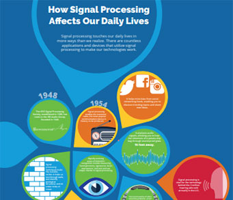
What is Signal Processing?

The technology we use, and even rely on, in our everyday lives –computers, radios, video, cell phones – is enabled by signal processing. Learn More » -
Publications & Resources
-
SPS Resources
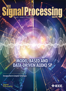
- Signal Processing Magazine The premier publication of the society.
- SPS Newsletter Monthly updates in Signal Processing
- SPS Resource Center Online library of tutorials, lectures, and presentations.
- SigPort Online repository for reports, papers, and more.
- SPS Feed The latest news, events, and more from the world of Signal Processing.
-
SPS Resources
-
Conferences & Events
-
Community & Involvement
-
Membership
- Join SPS The IEEE Signal Processing Magazine, Conference, Discounts, Awards, Collaborations, and more!
- Chapter Locator Find your local chapter and connect with fellow industry professionals, academics and students
- Women in Signal Processing Networking and engagement opportunities for women across signal processing disciplines
- Students Scholarships, conference discounts, travel grants, SP Cup, VIP Cup, 5-MICC
- Young Professionals Career development opportunities, networking
- Get Involved
-
Technical Committees
- Applied Signal Processing Systems
- Audio and Acoustic Signal Processing
- Bio Imaging and Signal Processing
- Computational Imaging
- Image Video and Multidimensional Signal Processing
- Information Forensics and Security
- Machine Learning for Signal Processing
- Multimedia Signal Processing
- Sensor Array and Multichannel
- Signal Processing for Communication and Networking
- Signal Processing Theory and Methods
- Speech and Language Processing
- Technical Working Groups
- More TC Resources
-
Membership
-
Professional Development
-
Professional Development
- Signal Processing Mentorship Academy (SigMA) Program
- Micro Mentoring Experience Program (MiME)
- Distinguished Lecturer Program
- Distinguished Lecturers
- Distinguished Lecturer Nominations
- Past Lecturers
- Distinguished Industry Speaker Program
- Distinguished Industry Speakers
- Distinguished Industry Speaker Nominations
- Industry Resources
- IEEE Training Materials
- Jobs in Signal Processing: IEEE Job Site
-
Career Resources
- SPS Education Program Educational content in signal processing and related fields.
- Distinguished Lecturer Program Chapters have access to educators and authors in the fields of Signal Processing
- Job Opportunities Signal Processing and Technical Committee specific job opportunities
- Job Submission Form Employers may submit opportunities in the area of Signal Processing.
-
Professional Development
-
For Volunteers
-
For Board & Committee Members
- Board Agenda/Minutes* Agendas, minutes and supporting documentation for Board and Committee Members
- SPS Directory* Directory of volunteers, society and division directory for Board and Committee Members.
- Membership Development Reports* Insight into the Society’s month-over-month and year-over-year growths and declines for Board and Committee Members
-
For Board & Committee Members
Popular Pages
Today's:
- Information for Authors
- (ICME 2026) 2026 IEEE International Conference on Multimedia and Expo
- IEEE Transactions on Information Forensics and Security
- IEEE Transactions on Image Processing
- IEEE Transactions on Multimedia
- Submit a Manuscript
- IEEE Journal of Selected Topics in Signal Processing
- (CAI 2026) IEEE Conference on Artificial Intelligence 2026
- (ICIP 2026) 2026 IEEE International Conference on Image Processing
- IEEE Signal Processing Letters
- Editorial Board
- Conference Call for Papers
- IEEE Transactions on Audio, Speech and Language Processing
- Unified EDICS
- (ISBI 2026) 2026 IEEE 23rd International Symposium on Biomedical Imaging
All time:
- Information for Authors
- Submit a Manuscript
- IEEE Transactions on Image Processing
- IEEE Transactions on Information Forensics and Security
- IEEE Transactions on Multimedia
- IEEE Transactions on Audio, Speech and Language Processing
- IEEE Signal Processing Letters
- IEEE Transactions on Signal Processing
- Conferences & Events
- IEEE Journal of Selected Topics in Signal Processing
- Information for Authors-SPL
- Conference Call for Papers
- Signal Processing 101
- IEEE Signal Processing Magazine
- Guidelines
Last viewed:
- IEEE Transactions on Multimedia
- Distinguished Lecturer Program
- Distinguished Industry Speakers
- SPS BSI Webinar: Integration of Brain Imaging and Genomics with Interpretable Multimodal Collaborative Learning
- Past DIS Speakers
- Distinguished Industry Speaker Program
- If You Cannot Come to Us, We Will Go to You...
- Unified EDICS
- (ICME 2025) 2025 IEEE International Conference on Multimedia and Expo
- Past Lecturers
- Distinguished Lecturers
- Information for Authors
- Call for Proposals: (WIFS 2026) 2026 IEEE International Workshop on Information Forensics and Security
- About Transactions on Information Forensics and Security
- 2025 59th Asilomar Conference on Signals, Systems, and Computers
Burgin, Mariko Sofie (University of Michigan) “Physics-based modeling for high-fidelity radar retrievals” (2014)
You are here
Newsletter Menu
Newsletter Categories
Top Reasons to Join SPS Today!
1. IEEE Signal Processing Magazine
2. Signal Processing Digital Library*
3. Inside Signal Processing Newsletter
4. SPS Resource Center
5. Career advancement & recognition
6. Discounts on conferences and publications
7. Professional networking
8. Communities for students, young professionals, and women
9. Volunteer opportunities
10. Coming soon! PDH/CEU credits
Click here to learn more.
News and Resources for Members of the IEEE Signal Processing Society
Burgin, Mariko Sofie (University of Michigan) “Physics-based modeling for high-fidelity radar retrievals” (2014)
Burgin, Mariko Sofie (University of Michigan) “Physics-based modeling for high-fidelity radar retrievals”, Advisor: Moghaddam, Mahta, Ulaby, Fawwaz T. (2014)
Knowledge of soil moisture on a global scale is crucial for understanding the Earth's water, energy, and carbon cycles. This dissertation is motivated by the need for accurate soil moisture estimates and focuses on the improvement of the retrieval of soil moisture based on active remote sensing over vegetated and forested areas. It addresses three important, but often neglected, aspects in radar imaging: ionospheric effects, effects of multispecies vegetation (heterogeneity at pixel level), and heterogeneity at landscape level. The first contribution of this dissertation is the development of a generalized radar scattering model as an advancement of current radar modeling techniques for vegetated areas at a fine-scale pixel level. It consists of a realistic multispecies representation of vegetated areas, realistic subsurface soil layer modeling, and inclusion of terrain topography. This modeling improvement allows greater applicability to different land cover types and generally higher accuracy for retrieval of soil moisture. Most coarse-scale satellite pixels (km-scale or coarser) contain highly heterogeneous scenes with fine-scale (100 m or finer) variability of soil moisture, soil texture, topography, and vegetation cover types. The second contribution is the development of spatial scaling techniques to investigate effects of landscape-level heterogeneity on radar scattering signatures. Using the above radar forward scattering model, which assumes homogeneity over fine scales, tailor-made models are derived for the contribution of fine-scale heterogeneity to the coarse-scale satellite pixel for effective soil moisture retrieval. Finally, the third contribution is the development of a self-contained calibration technique based on an end-to-end radar system model. The model includes the effects of the ionosphere allowing the use of spaceborne radar signals for accurate soil moisture retrieval from lower frequencies, such as L- and P-band.
These contributions in combination will greatly increase the usability of low-frequency spaceborne radar data for soil moisture retrieval: ionospheric effects are successfully mitigated, heterogeneity at landscape level is resolved, and fine-scale scenes are better modeled. All of these contributions ultimately allow improved fidelity in soil moisture retrieval. These contributions are immediately applicable in current missions such as the ongoing AirMOSS mission that observes root-zone soil moisture with a P-band radar at fine-scale resolution (100 m), and NASA's upcoming SMAP spaceborne mission, which will assess surface soil moisture with an L-band radar and radiometer at km-scale resolution (3 km).
For details, please visit the thesis page.
Open Calls
| Nomination/Position | Deadline |
|---|---|
| Call for Nominations for the SPS Chapter of the Year Award | 15 October 2025 |
| Call for Papers for 2026 LRAC Workshop | 22 October 2025 |
| Submit Your 2026 ICASSP Workshop Paper | 22 October 2025 |
| Submit a Proposal for ICASSP 2030 | 31 October 2025 |
| Call for Project Proposals: IEEE SPS SigMA Program - Signal Processing Mentorship Academy | 2 November 2025 |
| Submit Your Proposals for 2026 Member-Driven Initiatives | 21 November 2025 |
| IEEE Signal Processing Society Annual Election Opens on 17 October | 4 December 2025 |
Society News
- The Inaugural Signal Processing Cup at ICASSP 2014
- News from the Audio and Acoustic Signal Processing (AASP)-TC
- Nominations Open for 2014 Major SPS Awards
- IEEE’s Annual Election
- August 29th Deadline Approaching: Election of Members-at-Large and Directors-at-Large of SPS Board of Governors
- IEEE Loyalty Program
- Announcing SPS-EURASIP Partnership
- IEEE Fellow Program Celebrating its 50th Anniversary; Improvements Made to IEEE Fellow Nomination Process
- Nominate a Colleague for the IEEE Technical Activities Board Hall of Honor Recognition
- IEEE ResumeLab and IEEE MentorCentre
- Call for Participation: IEEE Signal Processing Cup 2015 at ICASSP2015
- Last Chance to Register for IEEE Sections Congress 2014
- vTools Release Announcement
- Upcoming Distinguished Lectures - August 2014
Technical Committee News
Research Opportunities
Publications News
Education & Resources
Conferences & Events
SPS Social Media
- IEEE SPS Facebook Page https://www.facebook.com/ieeeSPS
- IEEE SPS X Page https://x.com/IEEEsps
- IEEE SPS Instagram Page https://www.instagram.com/ieeesps/?hl=en
- IEEE SPS LinkedIn Page https://www.linkedin.com/company/ieeesps/
- IEEE SPS YouTube Channel https://www.youtube.com/ieeeSPS
Home | Sitemap | Contact | Accessibility | Nondiscrimination Policy | IEEE Ethics Reporting | IEEE Privacy Policy | Terms | Feedback
© Copyright 2025 IEEE - All rights reserved. Use of this website signifies your agreement to the IEEE Terms and Conditions.
A public charity, IEEE is the world's largest technical professional organization dedicated to advancing technology for the benefit of humanity.


