- Our Story
- Publications & Resources
- Publications & Resources
- Publications
- IEEE Signal Processing Magazine
- IEEE Journal of Selected Topics in Signal Processing
- IEEE Signal Processing Letters
- IEEE Transactions on Computational Imaging
- IEEE Transactions on Image Processing
- IEEE Transactions on Information Forensics and Security
- IEEE Transactions on Multimedia
- IEEE Transactions on Signal and Information Processing over Networks
- IEEE Transactions on Signal Processing
- IEEE TCI
- IEEE TSIPN
- Data & Challenges
- Submit Manuscript
- Guidelines
- Information for Authors
- Special Issue Deadlines
- Overview Articles
- Top Accessed Articles
- SPS Newsletter
- SigPort
- SPS Resource Center
- Publications FAQ
- Blog
- News
- Dataset Papers
- Conferences & Events
- Community & Involvement
- Professional Development
- For Volunteers
- Information for Authors-OJSP
-
Home
Conferences & Workshops13 September 2027 to 16 September 2027Conferences & Workshops29 October 2025 to 31 October 2025Conferences Events IEEE Signal Processing Magazine IEEE SPL Article IEEE TIFS Article IEEE TMM Article IEEE TSP Article Jobs in Signal Processing Lectures Machine Learning Seasonal Schools Signal Processing News SPM Article SPS Distinguished Lectures SPS Newsletter Article SPS Webinar SPS Webinars SPS Webinar Series Webinar webinars
-
Our Story
What is Signal Processing?

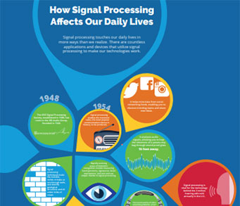
The technology we use, and even rely on, in our everyday lives –computers, radios, video, cell phones – is enabled by signal processing. Learn More » -
Publications & Resources
-
SPS Resources
- Signal Processing Magazine The premier publication of the society.
- SPS Newsletter Monthly updates in Signal Processing
- SPS Resource Center Online library of tutorials, lectures, and presentations.
- SigPort Online repository for reports, papers, and more.
- SPS Feed The latest news, events, and more from the world of Signal Processing.
-
SPS Resources
-
Conferences & Events
-
Community & Involvement
-
Membership
- Join SPS The IEEE Signal Processing Magazine, Conference, Discounts, Awards, Collaborations, and more!
- Chapter Locator Find your local chapter and connect with fellow industry professionals, academics and students
- Women in Signal Processing Networking and engagement opportunities for women across signal processing disciplines
- Students Scholarships, conference discounts, travel grants, SP Cup, VIP Cup, 5-MICC
- Young Professionals Career development opportunities, networking
- Get Involved
-
Technical Committees
- Applied Signal Processing Systems
- Audio and Acoustic Signal Processing
- Bio Imaging and Signal Processing
- Computational Imaging
- Image Video and Multidimensional Signal Processing
- Information Forensics and Security
- Machine Learning for Signal Processing
- Multimedia Signal Processing
- Sensor Array and Multichannel
- Signal Processing for Communication and Networking
- Signal Processing Theory and Methods
- Speech and Language Processing
- Technical Working Groups
- More TC Resources
-
Membership
-
Professional Development
-
Professional Development
- Signal Processing Mentorship Academy (SigMA) Program
- Micro Mentoring Experience Program (MiME)
- Distinguished Lecturer Program
- Distinguished Lecturers
- Distinguished Lecturer Nominations
- Past Lecturers
- Distinguished Industry Speaker Program
- Distinguished Industry Speakers
- Distinguished Industry Speaker Nominations
- Industry Resources
- IEEE Training Materials
- Jobs in Signal Processing: IEEE Job Site
-
Career Resources
- SPS Education Program Educational content in signal processing and related fields.
- Distinguished Lecturer Program Chapters have access to educators and authors in the fields of Signal Processing
- Job Opportunities Signal Processing and Technical Committee specific job opportunities
- Job Submission Form Employers may submit opportunities in the area of Signal Processing.
-
Professional Development
-
For Volunteers
-
For Board & Committee Members
- Board Agenda/Minutes* Agendas, minutes and supporting documentation for Board and Committee Members
- SPS Directory* Directory of volunteers, society and division directory for Board and Committee Members.
- Membership Development Reports* Insight into the Society’s month-over-month and year-over-year growths and declines for Board and Committee Members
-
For Board & Committee Members
Popular Pages
Today's:
- Information for Authors
- (ASRU 2025) 2025 IEEE Automatic Speech Recognition and Understanding Workshop
- IEEE Transactions on Multimedia
- IEEE Transactions on Information Forensics and Security
- (ISBI 2026) 2026 IEEE 23rd International Symposium on Biomedical Imaging
- (SPAWC 2025) 2025 IEEE Workshop on Signal Processing and Artificial Intelligence for Wireless Communications
- Information for Authors-SPL
- IEEE Transactions on Image Processing
- IEEE Signal Processing Letters
- MMSP TC Home
- IEEE Transactions on Signal Processing
- Unified EDICS
- Membership
- Guidelines for Reviewers
- IEEE Journal of Selected Topics in Signal Processing
All time:
- Information for Authors
- Submit a Manuscript
- IEEE Transactions on Image Processing
- IEEE Transactions on Information Forensics and Security
- IEEE Transactions on Multimedia
- IEEE Transactions on Audio, Speech and Language Processing
- IEEE Signal Processing Letters
- IEEE Transactions on Signal Processing
- Conferences & Events
- IEEE Journal of Selected Topics in Signal Processing
- Information for Authors-SPL
- Conference Call for Papers
- Signal Processing 101
- IEEE Signal Processing Magazine
- Guidelines
Last viewed:
- IEEE JSTSP Special Series on Artificial Intelligence for Smart Agriculture
- Call for Nominations
- Contact Technical Committee
- SPS Resource Center
- Information for Authors OJSP
- Information for Authors
- Submit a Manuscript
- Carla Pagliari
- SPS Mentors - SigMA Program
- Call for Project Proposals: IEEE SPS SigMA Program - Signal Processing Mentorship Academy
- Dynamic Dense Graph Convolutional Network for Skeleton-Based Human Motion Prediction
- (ASRU 2025) 2025 IEEE Automatic Speech Recognition and Understanding Workshop
- Steering Committee
- Call for Nominations: Fellow Reference Committee
- SPS Webinar: 25 March 2022, by Dr. Kaiming Shen - "Fractional Programming for Communication Systems"
Smart Rocks for Bridge Scour Monitoring: Design and Localization Using Electromagnetic Techniques and Embedded Orientation Sensors
You are here
Newsletter Menu
Newsletter Categories
Top Reasons to Join SPS Today!
1. IEEE Signal Processing Magazine
2. Signal Processing Digital Library*
3. Inside Signal Processing Newsletter
4. SPS Resource Center
5. Career advancement & recognition
6. Discounts on conferences and publications
7. Professional networking
8. Communities for students, young professionals, and women
9. Volunteer opportunities
10. Coming soon! PDH/CEU credits
Click here to learn more.
News and Resources for Members of the IEEE Signal Processing Society
Smart Rocks for Bridge Scour Monitoring: Design and Localization Using Electromagnetic Techniques and Embedded Orientation Sensors
Author: Radchenko, Andro (Missouri University of Science and Technology), 2017, Advisor: Pommerenke, David
River bridge scour is an erosion process in which flowing water removes sediment materials (such as sand, rocks) from a bridge foundation, river beds and banks. As a result, the level of the river bed near a bridge pier is lowering such that the bridge foundation stability can be compromised, and the bridge can collapse. The scour is a dynamic process, which can accelerate rapidly during a flood event. Thus, regular monitoring of the scour progress is necessary to be performed at most river bridges. Present techniques are usually expensive, require large man/hour efforts, and often lack the real-time monitoring capabilities.
In this dissertation a new method—‘Smart Rocks Network for bridge scour monitoring’ is introduced. The method is based on distributed wireless sensors embedded in ground underwater nearby the bridge pillars. The sensor nodes are unconstrained in movement, are equipped with years-lasting batteries and intelligent custom designed electronics, which minimizes power consumption during operation and communication. The electronic part consists of a microcontroller, communication interfaces, orientation and environment sensors (such as are accelerometer, magnetometer, temperature and pressure sensors), supporting power supplies and circuitries. Embedded in the soil nearby a bridge pillar the Smart Rocks can move/drift together with the sediments, and act as the free agent probes transmitting the unique signature signals to the base-station monitors. Individual movement of a Smart Rock can be remotely detected processing the orientation sensors reading. This can give an indication of the on-going scour progress, and set a flag for the on-site inspection. The map of the deployed Smart Rocks Network can be obtained utilizing the custom developed in-network communication protocol with signals intensity (RSSI) analysis. Particle Swarm Optimization (PSO) is applied for map reconstruction. Analysis of the map can provide detailed insight into the scour progress and topology. Smart Rocks Network wireless communication is based on the magnetoinductive (MI) link, at low (125 KHz) frequency, allowing for signal to penetrate through the water, rocks, and the bridge structure. The dissertation describes the Smart Rocks Network implementation, its electronic design and the electromagnetic/computational intelligence techniques used for the network mapping.
Open Calls
Society News
- 2018 Class of Distinguished Lecturers, Data Science DL and the New Distinguished Industry Speaker Program Announced
- IEEE ICASSP 2018 UPDATE New Date and Location
- DEADLINE EXTENDED - 12 October: Call for Nominations - N&A Committee and Awards Board
- Job Opportunities in Signal Processing
- IEEE SPS and TELUS Take Off with New Video on Air Canada Flights
- 2017 Member-Driven Initiative
- Upcoming Distinguished Lectures
- Election of Regional Directors-at-Large and Members-at-Large
- IEEE Signal Processing Society Launching Webinar Series
Conferences & Events
Education & Resources
Technical Committee News
Publications News
New Books
SPS Social Media
- IEEE SPS Facebook Page https://www.facebook.com/ieeeSPS
- IEEE SPS X Page https://x.com/IEEEsps
- IEEE SPS Instagram Page https://www.instagram.com/ieeesps/?hl=en
- IEEE SPS LinkedIn Page https://www.linkedin.com/company/ieeesps/
- IEEE SPS YouTube Channel https://www.youtube.com/ieeeSPS
Home | Sitemap | Contact | Accessibility | Nondiscrimination Policy | IEEE Ethics Reporting | IEEE Privacy Policy | Terms | Feedback
© Copyright 2025 IEEE - All rights reserved. Use of this website signifies your agreement to the IEEE Terms and Conditions.
A public charity, IEEE is the world's largest technical professional organization dedicated to advancing technology for the benefit of humanity.


